

Thorough topographic surveys
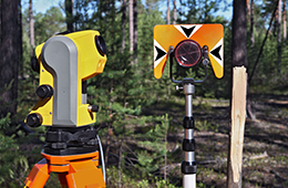
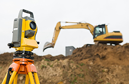
Topographic surveys are mainly used for design by engineers and architects. A 3-D model is generated using points of horizontal and vertical locations along break lines such as flow lines, swales, ridges, tops and toes of arroyo banks, tops and toes of concrete structures such as retaining walls, curbs and gutters, sidewalks, ramps, steps, etc.
Once the 3-D model is created and edited for accuracy, contours can be created at any contour interval or cross-sections can be generated at any alignment station.
Comprehensive surveying
In addition to labeled contours, topographic surveys will usually include boundary lines, easements, any boundary monuments found, improvements such as roads, buildings, sidewalks, curbs and gutters, retaining walls, planters, and visible utilities.
Contact Southern Colorado Surveying
to schedule your topographic survey today!